
Zoe is ready to set out canicrossing.
On a warm but comfortable day in early June, Eric and I set off on an approximately six mile canicross hike with Zoe and Okemo at Gunpowder Falls State Park in Northern Baltimore County. Our mission was to determine whether this hike was appropriate for one of our upcoming group canicross hikes. Got a high energy dog? Want to learn more about what canicross is? Visit the Canicross Hikes section on our website. Want to give Canicrossing a try with your dog? We have several upcoming canicross hikes scheduled throughout the summer. To learn more about our upcoming canicross hikes visit the Upcoming Events section of on our webpage. To check out more photos from our recent Canicross Hikes visit the Gallery page of our main website.
After arriving at the trail head, we harnessed the pups, put on our packs, checked our equipment and were off. As you can see in the photos, the pups were raring to go.

Zoe pulls hard as she sets off down the trail

Along the way Zoe took a dip to cool off in the Gunpowder Falls River.After arriving at the trail head, we harnessed the pups, put on our packs, checked our equipment and were off. As you can see in the photos, the pups were raring to go.

Zoe pulls hard as she sets off down the trail

Okemo trots down the trail: If you are not the lead dog, the view never changes.


Zoe and I make our way down the trail lined with ferns.
 Okemo demonstrates a perfect "line out" after a dip in the Gunpowder Falls river.
 Okemo demonstrates a perfect "line out" after a dip in the Gunpowder Falls river.
After parking the car and harnessing the dogs in their x-back harnesses and connecting them to our canicross belts, we set off on the Gunpowder South trail which meanders along the Gunpowder River for over 13 miles.
The going is at first easy; the trail is a narrow shaded footpath through ferns. We quickly pass the turn off for the Panther Branch trail (named for the panther that once lived in a cave visible from the Gunpowder South trail) and continue to wind our way along the river. At about one half mile, the trail winds very close to the river and is narrow and tricky to navigate due to wash outs and a tangle of tree roots. At this point, the trail along the river gets very narrow, becoming at some points just an eroded knife edge hanging over the water. As we move slowly along, we fine it helps to shorten the canicross lines by holding them in our hand as we make our way along the river and through a tangle of tree roots. The tricky footing is worth it as we reach a huge boulder protruding into the river which makes an excellent place to stop, water the dogs, and catch our breath. After about a half mile of tough going, the trail once again becomes an easy stroll along the river. Many small paths off to the left lead down to various "swimming holes" in the river. Across the river, we spy the remains of two old mills built in the mid 1700s nestled deep in a Hemlock grove. At about 2.5 miles, we pass the turn off for the Sandy Lane trail and cross a small stream where the dogs pause for a drink of water and to take a refreshing dip.
At approximately three miles, we exit the Gunpowder South trail at Big Falls Road planning to cross the river on the Big Falls Road bridge and return to our car via the Gunpowder North trail. Unfortunately, due to construction, the Big Falls Road bridge is out and, having no way to cross the river, we must return the way we came along the Gunpowder South Trail. Even though we couldn't take the Gunpowder North Trail and view Raven Rock Falls (not a high vertical water fall but a riffle of rock with water flowing over it).
Along the way, we saw mountain laurel, rocks, ferns, and some interesting flora and fauna.
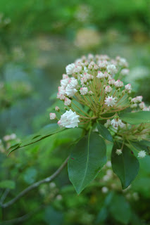
Flora

A centipede crawls across a log.The going is at first easy; the trail is a narrow shaded footpath through ferns. We quickly pass the turn off for the Panther Branch trail (named for the panther that once lived in a cave visible from the Gunpowder South trail) and continue to wind our way along the river. At about one half mile, the trail winds very close to the river and is narrow and tricky to navigate due to wash outs and a tangle of tree roots. At this point, the trail along the river gets very narrow, becoming at some points just an eroded knife edge hanging over the water. As we move slowly along, we fine it helps to shorten the canicross lines by holding them in our hand as we make our way along the river and through a tangle of tree roots. The tricky footing is worth it as we reach a huge boulder protruding into the river which makes an excellent place to stop, water the dogs, and catch our breath. After about a half mile of tough going, the trail once again becomes an easy stroll along the river. Many small paths off to the left lead down to various "swimming holes" in the river. Across the river, we spy the remains of two old mills built in the mid 1700s nestled deep in a Hemlock grove. At about 2.5 miles, we pass the turn off for the Sandy Lane trail and cross a small stream where the dogs pause for a drink of water and to take a refreshing dip.
At approximately three miles, we exit the Gunpowder South trail at Big Falls Road planning to cross the river on the Big Falls Road bridge and return to our car via the Gunpowder North trail. Unfortunately, due to construction, the Big Falls Road bridge is out and, having no way to cross the river, we must return the way we came along the Gunpowder South Trail. Even though we couldn't take the Gunpowder North Trail and view Raven Rock Falls (not a high vertical water fall but a riffle of rock with water flowing over it).
Along the way, we saw mountain laurel, rocks, ferns, and some interesting flora and fauna.

Flora

Even though this was not the hike we had set out to do, it was a nice day out with the dogs.


